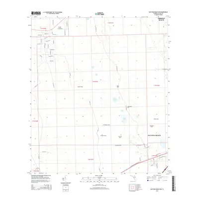
2015 Map of Daytona Beach NW
USGS Topo · Published 2015About this map
Gopher Ridge and Rima Ridge define the interior landscape of this region, providing slightly elevated ground amidst a complex network of wetlands and shallow lakes. Small bodies of water such as Indian Lake, Sawgrass Lake, and Scoggin Lake dot the terrain, while larger landforms like Tiger Bay Island and Big Bear Island emerge from the low-lying marshes. The northwestern fringes of Daytona Beach and Ormond Beach appear along the eastern edge of the survey, showing the residential expansion into the pine-named subdivisions north of Cross Creek Farms Airport. This area represents the interface between Florida’s coastal urban development and the wilder, boggy interior of the Tiger Bay state lands. Road networks including Center Rd and Rima Ridge Rd provide access into this wilderness, which is characterized by features like Bumcombe Hill and Danny Hole.
Find a feature on this map
62 named features on this map. Tap any name to fly to it.
Don’t see what you’re looking for? This feature index may not catch every label — zoom into the map to look around manually.
Map Details
Editions of this 2015 Daytona Beach NW Map
This is the sole edition of this map. No revisions or reprints were ever made.
Other maps of this area

1937 · Ormond
USGS Topo · 1:48,000

1944 · Ormond
USGS Topo · 1:62,500

1952 · Samsula
USGS Topo · 1:24,000

1952 · Daytona Beach
USGS Topo · 1:24,000

1954 · Daytona Beach
USGS Topo · 1:250,000

1956 · Favoretta
USGS Topo · 1:24,000

1956 · Ormond Beach
USGS Topo · 1:24,000

1958 · Daytona Beach
USGS Topo · 1:250,000

1962 · Daytona Beach NW
USGS Topo · 1:24,000

1962 · Daytona Beach SW
USGS Topo · 1:24,000