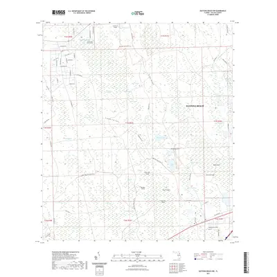
2021 Map of Daytona Beach NW
USGS Topo · Published 2021About this map
The Tiger Bay State Forest Trl winds through this interior landscape northwest of Daytona Beach, defining a region shaped by extensive wetlands and subtle elevation changes. The map reveals a transition between established residential clusters in the northwest—noted by roads like Conifer Dr and Tamarack Dr—and the largely undeveloped expanses of Bennett Swamp and Tiger Bay. Water dominates the hydrology of the area, from the larger Indian Lake and Sawgrass Lake to numerous named depressions such as Danny Hole and Burnt Out Bay. Significant terrain features like Rima Ridge and Gopher Ridge offer dry passage through the surrounding lowlands. Aviation history is present at the Squillacote Airport and Cross Creek Farms Airport, while family or local history researchers may find interest in landmarks such as Bumcombe Hill and Hammock Field.
Find a feature on this map
81 named features on this map. Tap any name to fly to it.
Don’t see what you’re looking for? This feature index may not catch every label — zoom into the map to look around manually.
Map Details
Editions of this 2021 Daytona Beach NW Map
This is the sole edition of this map. No revisions or reprints were ever made.
Other maps of this area

1937 · Ormond
USGS Topo · 1:48,000

1944 · Ormond
USGS Topo · 1:62,500

1952 · Samsula
USGS Topo · 1:24,000

1952 · Daytona Beach
USGS Topo · 1:24,000

1954 · Daytona Beach
USGS Topo · 1:250,000

1956 · Favoretta
USGS Topo · 1:24,000

1956 · Ormond Beach
USGS Topo · 1:24,000

1958 · Daytona Beach
USGS Topo · 1:250,000

1962 · Daytona Beach NW
USGS Topo · 1:24,000

1962 · Daytona Beach SW
USGS Topo · 1:24,000