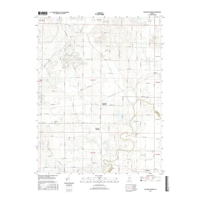
2016 Map of De Gonia Springs
USGS Topo · Published 2016About this map
De Gonia Springs and Ash Iron Springs anchor this portion of the Indiana landscape, where the terrain is defined by a dense network of drainage canals and natural waterways. The southern boundary of the map is shaped by the meandering course of Little Pigeon Creek, which also serves as the dividing line between Warrick Co and Spencer Co. The presence of numerous family and community burial grounds, such as Beasley Cem, Mill Cem, and Kelley Cem, provides significant points of interest for those tracing local lineages.
Find a feature on this map
103 named features on this map. Tap any name to fly to it.
Don’t see what you’re looking for? This feature index may not catch every label — zoom into the map to look around manually.
Map Details
Editions of this 2016 De Gonia Springs Map
This is the sole edition of this map. No revisions or reprints were ever made.
Other maps of this area

1900 · De Gonia Springs
USGS Topo · 1:62,500

1901 · Owensboro
USGS Topo · 1:62,500

1902 · Ditney
USGS Topo · 1:125,000

1902 · Degonia Springs
USGS Topo · 1:62,500

1902 · Boonville
USGS Topo · 1:62,500

1905 · Newburg
USGS Topo · 1:62,500

1951 · Yankeetown
USGS Topo · 1:24,000

1952 · Rockport
USGS Topo · 1:24,000

1954 · Evansville
USGS Topo · 1:250,000
1954 · Richland
USGS Topo · 1:24,000