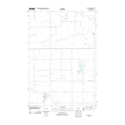
2010 Map of De Graff
USGS Topo · Published 2010About this map
De Graff serves as the primary hub of this agricultural landscape in Swift County, defined by a rigid grid of rural roads and the winding path of the East Branch Chippewa River. The village core is anchored by the Post Office and the Saint Bridget Cemetery, reflecting the enduring community foundations of the region. The surrounding prairie landscape is deeply managed by water engineering, most notably through County Ditch Number Sixtythree, which cuts across the townships to facilitate drainage alongside naturally occurring water bodies like Hollerberg Lake. Genealogists and local historians will find significant value in the distribution of religious landmarks, including the northern Saint Pauli Cemetery and the eastern Bethesda Lutheran Cemetery, which mark the early footprint of Norwegian and Catholic settlement patterns. Farther north, the Falk Wildlife Area Dam represents 21st-century conservation efforts along the river’s watershed.
Find a feature on this map
34 named features on this map. Tap any name to fly to it.
Don’t see what you’re looking for? This feature index may not catch every label — zoom into the map to look around manually.
Map Details
Editions of this 2010 De Graff Map
This is the sole edition of this map. No revisions or reprints were ever made.
Other maps of this area

1953 · Saint Cloud
USGS Topo · 1:250,000

1957 · Saint Cloud
USGS Topo · 1:250,000

1958 · Saint Cloud
USGS Topo · 1:250,000

1958 · Murdock
USGS Topo · 1:24,000

1958 · Gracelock NE
USGS Topo · 1:24,000

1958 · Kerkhoven
USGS Topo · 1:24,000

1968 · De Graff
USGS Topo · 1:24,000

1968 · Lake Hassel
USGS Topo · 1:24,000

1968 · Benson
USGS Topo · 1:24,000

1968 · Lake Simon
USGS Topo · 1:24,000