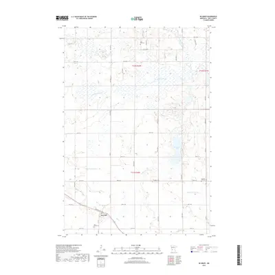
2019 Map of De Graff
USGS Topo · Published 2019About this map
The settlement of De Graff sits at the intersection of a significant regional transit corridor, where Atlantic Ave runs parallel to the rail line through the southwestern corner of this West-Central Minnesota landscape. The area is defined by its complex hydrology, featuring the E Br Chippewa River and the winding course of Mud Cr. Further east, the Hollerberg Lake and its associated Hollerberg Floodway demonstrate the water management and drainage patterns essential to this agricultural region.
Find a feature on this map
35 named features on this map. Tap any name to fly to it.
Don’t see what you’re looking for? This feature index may not catch every label — zoom into the map to look around manually.
Map Details
Editions of this 2019 De Graff Map
This is the sole edition of this map. No revisions or reprints were ever made.
Other maps of this area

1953 · Saint Cloud
USGS Topo · 1:250,000

1957 · Saint Cloud
USGS Topo · 1:250,000

1958 · Saint Cloud
USGS Topo · 1:250,000

1958 · Murdock
USGS Topo · 1:24,000

1958 · Gracelock NE
USGS Topo · 1:24,000

1958 · Kerkhoven
USGS Topo · 1:24,000

1968 · De Graff
USGS Topo · 1:24,000

1968 · Lake Hassel
USGS Topo · 1:24,000

1968 · Benson
USGS Topo · 1:24,000

1968 · Lake Simon
USGS Topo · 1:24,000