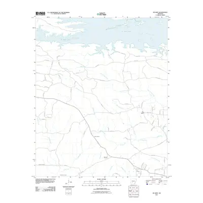
2011 Map of De Gray
USGS Topo · Published 2011About this map
De Gray Lake dominates the northern landscape of this region, its irregular southern shoreline characterized by numerous inlets and points such as Ozan Pt. South of the reservoir, the terrain is defined by a dense network of tributaries including De Gray Creek, White Oak Creek, and Bradshaw Creek that flow through the timbered hills. The small community of De Gray serves as a local focal point, surrounded by numerous family and community burial grounds that offer significant value for genealogical research.
Find a feature on this map
71 named features on this map. Tap any name to fly to it.
Don’t see what you’re looking for? This feature index may not catch every label — zoom into the map to look around manually.
Map Details
Editions of this 2011 De Gray Map
This is the sole edition of this map. No revisions or reprints were ever made.
Other maps of this area

1943 · Antoine
USGS Topo · 1:62,500

1955 · Little Rock
USGS Topo · 1:250,000

1956 · Little Rock
USGS Topo · 1:250,000

1959 · Caddo Valley
USGS Topo · 1:24,000

1959 · Arkadelphia
USGS Topo · 1:24,000

1960 · Little Rock
USGS Topo · 1:250,000

1964 · Little Rock
USGS Topo · 1:250,000

1966 · De Roche
USGS Topo · 1:24,000
1966 · Point Cedar
USGS Topo · 1:24,000
1966 · Bismarck
USGS Topo · 1:24,000