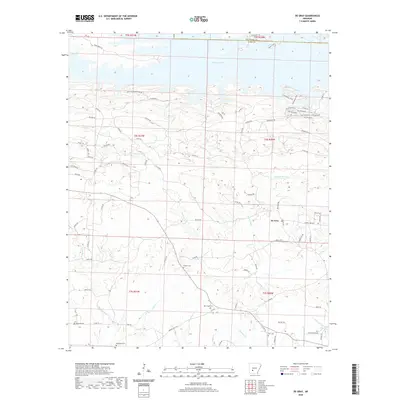
2020 Map of De Gray
USGS Topo · Published 2020About this map
De Gray Lake dominates the northern reaches of this landscape along the border of Hot Spring and Clark counties. The settlement of De Gray is located to the southeast, surrounded by a network of rural roads such as Terrell Rd and Mosley Rd. This area is particularly dense with family and community burial grounds, including Golden Cem, New Hope Cem, and Wingfield Cem, which offer significant value for genealogical research in this part of Arkansas.
Find a feature on this map
82 named features on this map. Tap any name to fly to it.
Don’t see what you’re looking for? This feature index may not catch every label — zoom into the map to look around manually.
Map Details
Editions of this 2020 De Gray Map
This is the sole edition of this map. No revisions or reprints were ever made.
Other maps of this area

1943 · Antoine
USGS Topo · 1:62,500

1955 · Little Rock
USGS Topo · 1:250,000

1956 · Little Rock
USGS Topo · 1:250,000

1959 · Caddo Valley
USGS Topo · 1:24,000

1959 · Arkadelphia
USGS Topo · 1:24,000

1960 · Little Rock
USGS Topo · 1:250,000

1964 · Little Rock
USGS Topo · 1:250,000

1966 · De Roche
USGS Topo · 1:24,000
1966 · Point Cedar
USGS Topo · 1:24,000
1966 · Bismarck
USGS Topo · 1:24,000