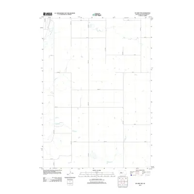
2012 Map of De Grey NW
USGS Topo · Published 2012About this map
Medicine Knoll Cr meanders through the northwest corner of this Hughes County landscape, defining the local drainage before the land transitions into a systematic grid of section roads. The map reveals a rural expanse in the early 21st century, dominated by agricultural parcels and scattered water bodies. The infrastructure is characterized by long-distance thoroughfares such as Canning Rd and Runge Rd, which connect the remote prairie sections. While the terrain is largely open, the dense network of numbered routes like 207th St and 314th Ave reflects the enduring Homestead-era layout of the South Dakota interior. This survey provides a clear view of the land before further modern development, showing the precise placement of individual farmsteads and rural access points.
Find a feature on this map
20 named features on this map. Tap any name to fly to it.
Don’t see what you’re looking for? This feature index may not catch every label — zoom into the map to look around manually.
Map Details
Editions of this 2012 De Grey NW Map
This is the sole edition of this map. No revisions or reprints were ever made.
Other maps of this area

1934 · Canning
USGS Topo · 1:48,000

1937 · Canning
USGS Topo · 1:62,500

1953 · Huron
USGS Topo · 1:250,000

1954 · Pierre
USGS Topo · 1:250,000

1954 · Huron
USGS Topo · 1:250,000

1958 · Pierre
USGS Topo · 1:250,000

1967 · Canning
USGS Topo · 1:24,000

1967 · Onida SE
USGS Topo · 1:24,000

1967 · Blunt
USGS Topo · 1:24,000

1967 · Blunt SE
USGS Topo · 1:24,000