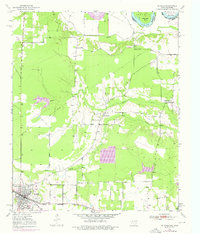
1950 Map of De Kalb
USGS Topo · Published 1976About this map
The Texas and Pacific railroad corridor serves as the primary southern axis for this pocket of Northeast Texas, connecting the community of De Kalb to the broader regional economy. Northward, the landscape transitions from these rail-adjacent settlements toward the meandering bottomlands of the Red River, which defines the border between Oklahoma and Texas. The terrain is shaped by the complex hydrology of Hooks Bayou, Holly Creek, and Mud Creek, creating a rural environment where land use is dictated by the river’s historical flooding and shifts, evidenced by Billy Hall Bend and Gunn Lake.
Find a feature on this map
19 named features on this map. Tap any name to fly to it.
Don’t see what you’re looking for? This feature index may not catch every label — zoom into the map to look around manually.
Map Details
Editions of this 1950 De Kalb Map
2 editions found
Other maps of this area

1909 · New Boston
USGS Topo · 1:62,500

1930 · Bassett
USGS Topo · 1:62,500

1950 · De Kalb NW
USGS Topo · 1:24,000

1950 · Tom
USGS Topo · 1:24,000

1950 · De Kalb
USGS Topo · 1:24,000

1950 · Oak Grove
USGS Topo · 1:24,000

1951 · De Kalb
USGS Topo · 1:24,000

1951 · De Kalb NW
USGS Topo · 1:24,000

1951 · Tom
USGS Topo · 1:24,000

1951 · Oak Grove
USGS Topo · 1:24,000