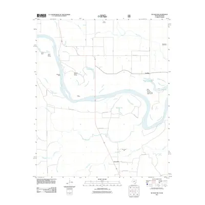
2011 Map of De Kalb NW
USGS Topo · Published 2011About this map
Red River oxbows and cut-offs define the landscape of the Oklahoma-Texas border on this 2011 survey. The shifting course of the river has left a series of prominent features such as Harris Bend Cut Off and Whitaker Bend Cut Off, which illustrate the dynamic nature of this fluvial boundary. Smaller settlements like Goodlake and Beaverdam are situated on the higher ground away from the floodplains, connected by a network of rural routes including Black Land Rd and Mudline Rd. The map provides specific historical reference points for genealogists, notably Harris Cemetery near Push Creek and the family-named Jim Jones Hill. Water management and natural catchment areas are also documented, ranging from larger bodies like Winston Lake to the engineered Oknoname 089018 Dam.
Find a feature on this map
31 named features on this map. Tap any name to fly to it.
Don’t see what you’re looking for? This feature index may not catch every label — zoom into the map to look around manually.
Map Details
Editions of this 2011 De Kalb NW Map
This is the sole edition of this map. No revisions or reprints were ever made.
Other maps of this area

1950 · De Kalb NW
USGS Topo · 1:24,000

1950 · Haworth
USGS Topo · 1:24,000

1950 · Tom
USGS Topo · 1:24,000

1950 · De Kalb
USGS Topo · 1:24,000

1950 · Oak Grove
USGS Topo · 1:24,000

1950 · Bokhoma
USGS Topo · 1:24,000

1951 · Idabel SE
USGS Topo · 1:24,000

1951 · De Kalb
USGS Topo · 1:24,000

1951 · English
USGS Topo · 1:24,000

1951 · De Kalb NW
USGS Topo · 1:24,000