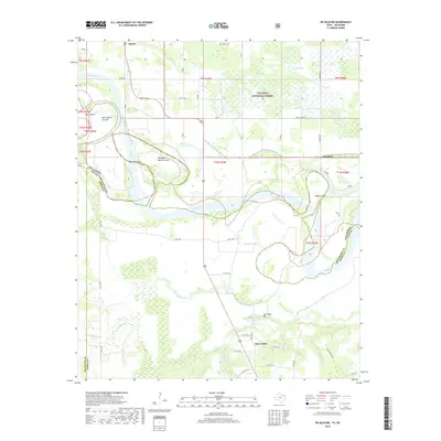
2019 Map of De Kalb NW
USGS Topo · Published 2019About this map
The Red River creates a complex, shifting border between Oklahoma and Texas, defining the landscape with dramatic oxbows and evidence of historical course changes. This 2019 survey captures the river's dynamic nature through features like Whitaker Bend, Harris Bend, and the 1908 Cut-Off. To the north, the terrain transitions into the wetlands and marshes of the Ouachita National Forest, where Red Slough and Push Cr drain into the river basin.
Find a feature on this map
48 named features on this map. Tap any name to fly to it.
Don’t see what you’re looking for? This feature index may not catch every label — zoom into the map to look around manually.
Map Details
Editions of this 2019 De Kalb NW Map
This is the sole edition of this map. No revisions or reprints were ever made.
Other maps of this area

1950 · De Kalb NW
USGS Topo · 1:24,000

1950 · Haworth
USGS Topo · 1:24,000

1950 · Tom
USGS Topo · 1:24,000

1950 · De Kalb
USGS Topo · 1:24,000

1950 · Oak Grove
USGS Topo · 1:24,000

1950 · Bokhoma
USGS Topo · 1:24,000

1951 · Idabel SE
USGS Topo · 1:24,000

1951 · De Kalb
USGS Topo · 1:24,000

1951 · English
USGS Topo · 1:24,000

1951 · De Kalb NW
USGS Topo · 1:24,000