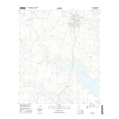
2016 Map of De Leon
USGS Topo · Published 2016About this map
The Sabana River valley defines the character of this Comanche County landscape, dominated by a complex network of reservoirs and water control features. The city of De Leon sits at the northern end of this corridor, where a traditional grid of streets like W Navarro St and E Lasalle St meets the rural agricultural expanse. To the south, the settlement of Downing occupies a bend in the river near where the waters flow toward the northern reaches of Proctor Lake. Local history is anchored by family-named landmarks such as Jerry Solomon Lake, A G Lee Lake, and McGinnis Lake, which suggest a long-standing pattern of private water management and land ownership. The presence of the Ebenezer Cem provides a focal point for genealogical research in this rural Texas community, while numerous creeks like Copperas Cr and Rush Creek feed into the central river system.
Find a feature on this map
85 named features on this map. Tap any name to fly to it.
Don’t see what you’re looking for? This feature index may not catch every label — zoom into the map to look around manually.
Map Details
Editions of this 2016 De Leon Map
This is the sole edition of this map. No revisions or reprints were ever made.
Other maps of this area

1888 · Hamilton
USGS Topo · 1:125,000

1889 · Brownwood
USGS Topo · 1:125,000

1890 · Stephenville
USGS Topo · 1:125,000

1894 · Hamilton
USGS Topo · 1:125,000

1894 · Eastland
USGS Topo · 1:125,000

1894 · Brownwood
USGS Topo · 1:125,000

1920 · Stephenville
USGS Topo · 1:125,000

1954 · Brownwood
USGS Topo · 1:250,000

1954 · Abilene
USGS Topo · 1:250,000

1956 · Gustine
USGS Topo · 1:62,500