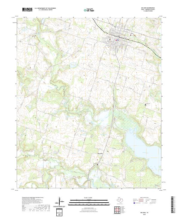
2022 Map of De Leon
USGS Topo · Published 2022About this map
De Leon sits at the northern edge of a landscape defined by the convergence of the Sabana River and the Leon River as they feed into Proctor Lake. This modern survey illustrates a region where local water management and agricultural drainage are central, marked by numerous small reservoirs such as Spruill Lake Number 1, A G Lee Lake, and Jerry Solomon Lake. The street grid of De Leon shows its historical core, while the outlying areas near the settlement of Downing maintain a rural character. For those researching family history in Comanche County, the map provides precise locations for several burial grounds, including the Old De Leon Cem and the Ebenezer Cem to the east. The terrain is further etched by a network of seasonal waterways like Turkey Cr and Rush Creek, which navigate the subtle elevation changes of the central Texas plains.
Find a feature on this map
81 named features on this map. Tap any name to fly to it.
Don’t see what you’re looking for? This feature index may not catch every label — zoom into the map to look around manually.
Map Details
Editions of this 2022 De Leon Map
This is the sole edition of this map. No revisions or reprints were ever made.
Other maps of this area

1888 · Hamilton
USGS Topo · 1:125,000

1889 · Brownwood
USGS Topo · 1:125,000

1890 · Stephenville
USGS Topo · 1:125,000

1894 · Hamilton
USGS Topo · 1:125,000

1894 · Eastland
USGS Topo · 1:125,000

1894 · Brownwood
USGS Topo · 1:125,000

1920 · Stephenville
USGS Topo · 1:125,000

1954 · Brownwood
USGS Topo · 1:250,000

1954 · Abilene
USGS Topo · 1:250,000

1956 · Gustine
USGS Topo · 1:62,500