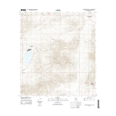
2015 Map of De Long Mountains A-2 SE
USGS Topo · Published 2015About this map
Red Dog Mine dominates the western landscape of this 2015 survey, highlighting one of the most significant industrial footprints in the remote De Long Mountains. The operation is supported by the dedicated Red Dog Airport and the winding Red Dog Mine Road, which cuts through the high-elevation terrain to provide essential access. To the east and northeast, the landscape shifts toward protected wilderness within the Noatak National Preserve. Significant topographical landmarks including Deadlock Mtn and the drainage of Red Dog Cr define the surrounding basin, illustrating the stark contrast between active resource extraction and federally preserved tundra. This map captures the intersection of heavy industry and Arctic conservation at the height of modern mining operations in the Brooks Range.
Find a feature on this map
12 named features on this map. Tap any name to fly to it.
Don’t see what you’re looking for? This feature index may not catch every label — zoom into the map to look around manually.
Map Details
Editions of this 2015 De Long Mountains A-2 SE Map
This is the sole edition of this map. No revisions or reprints were ever made.
Other maps of this area

1951 · De Long Mountains
USGS Topo · 1:250,000

1951 · Noatak
USGS Topo · 1:250,000

1955 · Noatak
USGS Topo · 1:250,000

1955 · De Long Mountains
USGS Topo · 1:250,000

1955 · Noatak D-2
USGS Topo · 1:63,360

1955 · De Long Mountains A-1
USGS Topo · 1:63,360

1955 · De Long Mountains A-2
USGS Topo · 1:63,360

1964 · Noatak
USGS Topo · 1:250,000

1965 · De Long Mountains
USGS Topo · 1:250,000
2015 · De Long Mountains A-2 NW
USGS Topo · 1:25,000