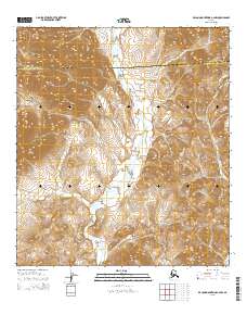
2015 Map of De Long Mountains A-2 NW
USGS Topo · Published 2015About this map
De Long Mountains terrain dominates this 2015 survey, where the administrative boundary between the North Slope Borough and the Northwest Arctic Borough cuts across the northern reaches. The landscape is defined by the drainage patterns of the Wulik River, which snakes through the central valley, and Ikalukrok Cr in the east. This map provides a technical view of the remote Brooks Range foothills before further 21st-century environmental shifts, recorded with high-precision contour intervals. The absence of permanent settlements or roads highlights the isolation of this Arctic region, focusing instead on the hydrography and elevation data critical for navigating this portion of Northwest Alaska.
Find a feature on this map
8 named features on this map. Tap any name to fly to it.
Don’t see what you’re looking for? This feature index may not catch every label — zoom into the map to look around manually.
Map Details
Editions of this 2015 De Long Mountains A-2 NW Map
This is the sole edition of this map. No revisions or reprints were ever made.
Other maps of this area

1951 · De Long Mountains
USGS Topo · 1:250,000

1955 · De Long Mountains
USGS Topo · 1:250,000

1955 · De Long Mountains A-3
USGS Topo · 1:63,360

1955 · De Long Mountains A-2
USGS Topo · 1:63,360

1955 · De Long Mountains B-3
USGS Topo · 1:63,360

1955 · De Long Mountains B-2
USGS Topo · 1:63,360

1965 · De Long Mountains
USGS Topo · 1:250,000
2015 · De Long Mountains B-2 SE
USGS Topo · 1:25,000
2015 · De Long Mountains A-3 SE
USGS Topo · 1:25,000
2015 · De Long Mountains B-2 SW
USGS Topo · 1:25,000