
1955 Map of De Long Mountains A-3
USGS Topo · Published 1967About this map
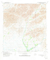
The Wulik Peaks dominate the northern landscape of this 1955 survey of the Northwest Arctic, where high-altitude ridges give way to complex drainage systems. To the southeast, the massive form of Punupkahkroak Mountain stands as a prominent landmark. These features are documented through photogrammetric methods from aerial photography taken by the Army Map Service in the mid-1950s. The southern reaches of the map are defined by the winding course of the Wulik River, which serves as the primary hydrological artery for the region. The map reveals an area entirely devoid of roads or trails during this era, illustrating the extreme isolation of this Arctic wilderness before modern infrastructure development. This survey serves as a fundamental record of the untouched topography and indigenous place names in this remote corner of Alaska.
Find a feature on this map
3 named features on this map. Tap any name to fly to it.
Don’t see what you’re looking for? This feature index may not catch every label — zoom into the map to look around manually.
Map Details
Editions of this 1955 De Long Mountains A-3 Map
2 editions found
Other maps of this area

1951 · De Long Mountains
USGS Topo · 1:250,000

1951 · Noatak
USGS Topo · 1:250,000

1955 · Noatak
USGS Topo · 1:250,000

1955 · De Long Mountains
USGS Topo · 1:250,000

1955 · Noatak D-4
USGS Topo · 1:63,360

1955 · Noatak D-3
USGS Topo · 1:63,360

1955 · De Long Mountains A-4
USGS Topo · 1:63,360

1955 · De Long Mountains A-2
USGS Topo · 1:63,360

1955 · De Long Mountains B-3
USGS Topo · 1:63,360
1955 · De Long Mountains B-4
USGS Topo · 1:63,360