
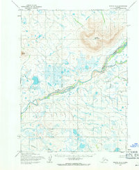
1955 Map of Noatak D-4
USGS Topo · Published 1964About this map
Iyikrok Mountain dominates the northeastern landscape of this mid-century survey, rising above a vast network of watercourses and marshland. The Wulik River winds broadly through the central terrain, fed by several significant tributaries including Ikalukrok Creek and Tutak Creek. To the west, Mount Jarvis provides another significant landmark in this high-latitude territory. The map reflects a landscape defined by natural hydrology rather than human settlement, with the Kateel River Meridian serving as the primary surveying reference for the Bureau of Land Management. The distribution of lakes and meandering streams across the lowlands suggests a complex drainage system typical of the region's arctic geography. This representation was developed from aerial photography taken in the early 1950s by the Army Map Service, documenting the terrain before significant modern infrastructure development.
Find a feature on this map
6 named features on this map. Tap any name to fly to it.
Don’t see what you’re looking for? This feature index may not catch every label — zoom into the map to look around manually.
Map Details
Editions of this 1955 Noatak D-4 Map
2 editions found
Other maps of this area

1951 · De Long Mountains
USGS Topo · 1:250,000

1951 · Noatak
USGS Topo · 1:250,000
1952 · Noatak C-5
USGS Topo · 1:63,360

1955 · Noatak
USGS Topo · 1:250,000

1955 · De Long Mountains
USGS Topo · 1:250,000

1955 · Noatak D-3
USGS Topo · 1:63,360

1955 · De Long Mountains A-3
USGS Topo · 1:63,360

1955 · De Long Mountains A-4
USGS Topo · 1:63,360

1955 · Noatak C-4
USGS Topo · 1:63,360

1955 · Noatak C-3
USGS Topo · 1:63,360