
1955 Map of Noatak C-4
USGS Topo · Published 1970About this map
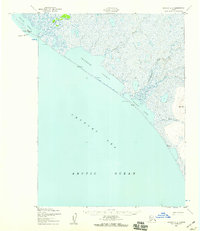
The Mulgrave Mountains dominate the interior landscape of this 1950s survey, representing a formidable coastal range along the Chukchi Sea coastline. A primary Winter Trail provides the only mapped inland route, skirting the shoreline of Imik Lagoon and following the low-lying coastal plains before heading north. The drainage system is characterized by numerous seasonal and perennial flows including New Heart Creek, Umagatsiak Creek, and Agagrak Creek, which carve through the elevations of Tahinichok and past Igiglogruk Mountain. These features indicate a landscape where travel was strictly dictated by seasonal freeze and terrain, with the Winter Trail marking a vital connection between the sea and the interior high ground of Omikviorok and the Rabbit Creek valley.
Find a feature on this map
13 named features on this map. Tap any name to fly to it.
Don’t see what you’re looking for? This feature index may not catch every label — zoom into the map to look around manually.
Map Details
Editions of this 1955 Noatak C-4 Map
This is the sole edition of this map. No revisions or reprints were ever made.
Other maps of this area

1951 · Noatak
USGS Topo · 1:250,000
1952 · Noatak C-5
USGS Topo · 1:63,360

1955 · Noatak
USGS Topo · 1:250,000

1955 · Noatak D-4
USGS Topo · 1:63,360

1955 · Noatak D-3
USGS Topo · 1:63,360

1955 · Noatak B-3
USGS Topo · 1:63,360

1955 · Noatak C-3
USGS Topo · 1:63,360

1955 · Noatak B-4
USGS Topo · 1:63,360
1955 · Noatak D-5
USGS Topo · 1:63,360

1964 · Noatak
USGS Topo · 1:250,000