
1955 Map of Noatak B-4
USGS Topo · Published 1970About this map
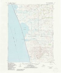
The Chukchi Sea coastline dominates this mid-1950s survey, revealing a landscape of lagoons and coastal marshes where the land meets the Arctic waters. A distinctive Winter Trail runs parallel to the shore, connecting various small cabins that represent the sparse human footprint in this remote region. These coastal features, including Imik Lagoon, Kotlik Lagoon, and Tasaychek Lagoon, are separated from the open sea by narrow spits, a characteristic geomorphology of the northwestern Alaskan coast.
Find a feature on this map
16 named features on this map. Tap any name to fly to it.
Don’t see what you’re looking for? This feature index may not catch every label — zoom into the map to look around manually.
Map Details
Editions of this 1955 Noatak B-4 Map
2 editions found
Other maps of this area

1951 · Noatak
USGS Topo · 1:250,000

1952 · Noatak A-3
USGS Topo · 1:63,360
1952 · Noatak A-4
USGS Topo · 1:63,360
1952 · Noatak C-5
USGS Topo · 1:63,360

1955 · Noatak
USGS Topo · 1:250,000

1955 · Noatak B-3
USGS Topo · 1:63,360

1955 · Noatak C-4
USGS Topo · 1:63,360

1955 · Noatak C-3
USGS Topo · 1:63,360

1964 · Noatak
USGS Topo · 1:250,000
2014 · Noatak C-4 SE
USGS Topo · 1:25,000