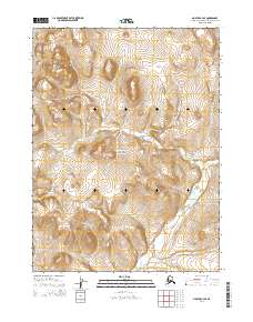
2014 Map of Noatak C-4 SE
USGS Topo · Published 2014About this map
Cape Krusenstern National Monument encompasses the heart of this landscape, preserving a vast coastal Arctic ecosystem and important archaeological history. The terrain is defined by the prominent Tahinichok Mountains in the northwest and the Mulgrave Hills toward the center, rising above the surrounding tundra. This 2014 survey captures the untouched drainage patterns of Agagrak Cr and Rabbit Cr, which wind through the township and range grids of the Northwest Arctic Borough. The presence of Umagatsiak Hill provides a distinct topographical landmark within the monument's boundaries. This region remains largely roadless, emphasizing the primitive and protected nature of the northern wilderness as it was documented early in the twenty-first century.
Find a feature on this map
14 named features on this map. Tap any name to fly to it.
Don’t see what you’re looking for? This feature index may not catch every label — zoom into the map to look around manually.
Map Details
Editions of this 2014 Noatak C-4 SE Map
This is the sole edition of this map. No revisions or reprints were ever made.
Other maps of this area

1951 · Noatak
USGS Topo · 1:250,000

1955 · Noatak
USGS Topo · 1:250,000

1955 · Noatak B-3
USGS Topo · 1:63,360

1955 · Noatak C-4
USGS Topo · 1:63,360

1955 · Noatak C-3
USGS Topo · 1:63,360

1955 · Noatak B-4
USGS Topo · 1:63,360

1964 · Noatak
USGS Topo · 1:250,000
2014 · Noatak C-3 NW
USGS Topo · 1:25,000
2014 · Noatak C-4 NE
USGS Topo · 1:25,000
2014 · Noatak B-4 NE
USGS Topo · 1:25,000