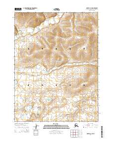
2014 Map of Noatak B-4 NE
USGS Topo · Published 2014About this map
Cape Krusenstern National Monument occupies the central portion of this Northwest Arctic landscape, preserved for its immense archaeological and cultural importance. The terrain is defined by the drainage patterns of small, wandering waterways, notably Rabbit Creek in the northwest and Jade Creek winding through the eastern sections. This 2014 survey captures a section of the Alaskan wilderness where the land is strictly partitioned by the Public Land Survey System, including townships such as t24n r23w and t23n r22w. The lack of road infrastructure or permanent settlements highlighted on the map reflects the remote, protected status of this monument land, where the natural topography and hydrologic features like Jade Creek remain the primary landmarks for navigation and study.
Find a feature on this map
7 named features on this map. Tap any name to fly to it.
Don’t see what you’re looking for? This feature index may not catch every label — zoom into the map to look around manually.
Map Details
Editions of this 2014 Noatak B-4 NE Map
This is the sole edition of this map. No revisions or reprints were ever made.
Other maps of this area

1951 · Noatak
USGS Topo · 1:250,000

1955 · Noatak
USGS Topo · 1:250,000

1955 · Noatak B-3
USGS Topo · 1:63,360

1955 · Noatak C-4
USGS Topo · 1:63,360

1955 · Noatak C-3
USGS Topo · 1:63,360

1955 · Noatak B-4
USGS Topo · 1:63,360

1964 · Noatak
USGS Topo · 1:250,000
2014 · Noatak C-4 SE
USGS Topo · 1:25,000
2014 · Noatak B-4 SE
USGS Topo · 1:25,000
2014 · Noatak B-4 SW
USGS Topo · 1:25,000