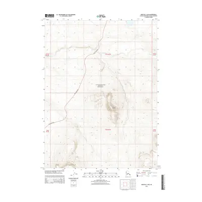
2014 Map of Noatak C-4 NE
USGS Topo · Published 2014About this map
Igliglogruk Mountain dominates the central terrain of this Arctic landscape, rising above the surrounding tundra and drainages of the Omikviorok River. A significant portion of the land is protected within the Cape Krusenstern National Monument, preserving a wilderness area critical to the Northwest Arctic's natural and cultural heritage. The most prominent human feature is the Red Dog Mine Road, which cuts a north-south path through the western sections of the map, serving as a vital industrial artery for the region. Smaller water bodies like Iglupiak provide additional detail to the hydrologic network of this remote northern borough during the early twenty-first century.
Find a feature on this map
11 named features on this map. Tap any name to fly to it.
Don’t see what you’re looking for? This feature index may not catch every label — zoom into the map to look around manually.
Map Details
Editions of this 2014 Noatak C-4 NE Map
This is the sole edition of this map. No revisions or reprints were ever made.
Other maps of this area

1951 · Noatak
USGS Topo · 1:250,000

1955 · Noatak
USGS Topo · 1:250,000

1955 · Noatak D-4
USGS Topo · 1:63,360

1955 · Noatak D-3
USGS Topo · 1:63,360

1955 · Noatak C-4
USGS Topo · 1:63,360

1955 · Noatak C-3
USGS Topo · 1:63,360

1964 · Noatak
USGS Topo · 1:250,000
2014 · Noatak D-4 SE
USGS Topo · 1:25,000
2014 · Noatak D-4 SW
USGS Topo · 1:25,000
2014 · Noatak C-4 SE
USGS Topo · 1:25,000