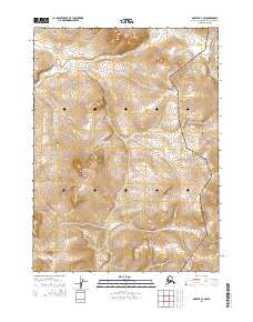
2014 Map of Noatak C-3 NW
USGS Topo · Published 2014About this map
Cape Krusenstern National Monument dominates this coastal landscape in the Northwest Arctic Borough, a protected expanse of Arctic tundra and dramatic coastal plains. The topography is defined by the Mulgrave Hills, which rise above the western half of the map, and a network of waterways including the Omikviorok River and Rabbit Cr. This area is characterized by its isolation and lack of permanent settlements, reflecting the wild state of the region in the early twenty-first century. The intricate contour lines illustrate the subtle drainage patterns as water flows from the high ridges toward the Chukchi Sea, revealing the complex hydrology of the high Arctic. Researchers can trace the meandering path of Kiyak Cr and study the landforms within the monument's boundary, where the interaction of elevation and permafrost-driven river systems is visible.
Find a feature on this map
9 named features on this map. Tap any name to fly to it.
Don’t see what you’re looking for? This feature index may not catch every label — zoom into the map to look around manually.
Map Details
Editions of this 2014 Noatak C-3 NW Map
This is the sole edition of this map. No revisions or reprints were ever made.
Other maps of this area

1951 · Noatak
USGS Topo · 1:250,000

1955 · Noatak
USGS Topo · 1:250,000

1955 · Noatak D-4
USGS Topo · 1:63,360

1955 · Noatak D-3
USGS Topo · 1:63,360

1955 · Noatak C-4
USGS Topo · 1:63,360

1955 · Noatak C-3
USGS Topo · 1:63,360

1964 · Noatak
USGS Topo · 1:250,000
2014 · Noatak D-3 SE
USGS Topo · 1:25,000
2014 · Noatak D-4 SE
USGS Topo · 1:25,000
2014 · Noatak C-4 SE
USGS Topo · 1:25,000