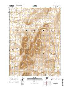
2014 Map of Noatak D-3 SE
USGS Topo · Published 2014About this map
Cape Krusenstern National Monument dominates the southwestern portion of this map, representing a landscape with archaeological and cultural depth. The terrain is defined by the significant rise of Kikmiksot Mountain and the neighboring Mulgrave Hills, which provide the high-relief backdrop for the region's drainage systems. These highlands feed several vital waterways including the Omikviorok River, which winds through the lower elevations toward the Chukchi Sea coast. The mapping of Tutak Cr, Kuchak Cr, and Kuyak Cr illustrates a complex network of seasonal and perennial streams that have long influenced movement through this part of the Northwest Arctic. This survey provides a precise look at the land's contours and the boundaries of federal protection areas as they existed in the early 21st century.
Find a feature on this map
13 named features on this map. Tap any name to fly to it.
Don’t see what you’re looking for? This feature index may not catch every label — zoom into the map to look around manually.
Map Details
Editions of this 2014 Noatak D-3 SE Map
This is the sole edition of this map. No revisions or reprints were ever made.
Other maps of this area

1951 · Noatak
USGS Topo · 1:250,000

1955 · Noatak
USGS Topo · 1:250,000

1955 · Noatak D-3
USGS Topo · 1:63,360

1955 · Noatak D-2
USGS Topo · 1:63,360

1955 · Noatak C-2
USGS Topo · 1:63,360

1955 · Noatak C-3
USGS Topo · 1:63,360

1964 · Noatak
USGS Topo · 1:250,000
2014 · Noatak C-3 NW
USGS Topo · 1:25,000
2014 · Noatak D-3 NW
USGS Topo · 1:25,000
2014 · Noatak D-3 SW
USGS Topo · 1:25,000