
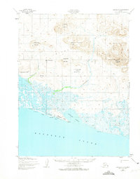
1952 Map of Noatak A-3
USGS Topo · Published 1958About this map
Kotzebue Sound defines the southern edge of this Arctic coastal survey, where the terrestrial landscape transitions into a vast network of marshes and tidal flats. The Tookrook River and Sittookooyook River drain into the extensive Aukoolak Lagoon, a prominent coastal feature separated from the open sound by narrow spits. The map records traces of seasonal or transitory human presence in this environment, including a Shelter Cabin and an Old Camp Site located along the northern bank of the river mouth.
Find a feature on this map
16 named features on this map. Tap any name to fly to it.
Don’t see what you’re looking for? This feature index may not catch every label — zoom into the map to look around manually.
Map Details
Editions of this 1952 Noatak A-3 Map
2 editions found
Other maps of this area

1951 · Noatak
USGS Topo · 1:250,000

1951 · Kotzebue
USGS Topo · 1:250,000

1951 · Kotzebue D-2
USGS Topo · 1:63,360
1952 · Noatak A-4
USGS Topo · 1:63,360

1955 · Noatak
USGS Topo · 1:250,000

1955 · Noatak B-3
USGS Topo · 1:63,360

1955 · Noatak B-4
USGS Topo · 1:63,360

1955 · Noatak B-2
USGS Topo · 1:63,360
1955 · Noatak A-2
USGS Topo · 1:63,360

1958 · Kotzebue
USGS Topo · 1:250,000