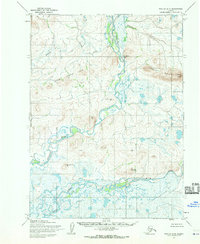
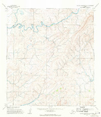
1955 Map of Noatak D-5
USGS Topo · Published 1970About this map
The Kivalina River and the Wulik River dominate this subarctic landscape in the mid-1950s, winding through an area devoid of roads or established settlements. This territory, mapped by the Army Map Service from 1952 aerial photography, is defined by its dramatic topographic shifts, from the low-lying tundra and wetlands to the prominent Kisimilot Mountains and Mount Jarvis in the northeast.
Find a feature on this map
13 named features on this map. Tap any name to fly to it.
Don’t see what you’re looking for? This feature index may not catch every label — zoom into the map to look around manually.
Map Details
Editions of this 1955 Noatak D-5 Map
2 editions found
Other maps of this area

1951 · De Long Mountains
USGS Topo · 1:250,000

1951 · Noatak
USGS Topo · 1:250,000
1952 · Noatak C-5
USGS Topo · 1:63,360

1955 · Noatak
USGS Topo · 1:250,000

1955 · De Long Mountains
USGS Topo · 1:250,000

1955 · Noatak D-4
USGS Topo · 1:63,360

1955 · De Long Mountains A-4
USGS Topo · 1:63,360
1955 · Noatak D-6
USGS Topo · 1:63,360

1955 · Noatak C-4
USGS Topo · 1:63,360
1955 · De Long Mountains A-5
USGS Topo · 1:63,360