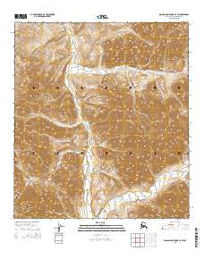
2015 Map of De Long Mountains B-2 SW
USGS Topo · Published 2015About this map
The Wulik River winds through this northern Alaskan landscape, carving a valley between the high ridges of the De Long Mountains. This 2015 U.S. Geological Survey representation reveals a terrain defined by dramatic elevation changes, where Sheep Mtn serves as a prominent landmark in the eastern portion of the quadrangle. The map is primarily characterized by its remote hydrology and complex topographic contours, with the river system acting as the primary geographical anchor for the surrounding wilderness. For researchers and geologists, the sheet offers a clear look at the drainage patterns and landforms of the North Slope Borough, including the surveyed townships of T34N and T33N. The lack of human infrastructure or named settlements highlights the isolated nature of this Arctic environment, focusing instead on the natural features that have shaped the region's history.
Find a feature on this map
11 named features on this map. Tap any name to fly to it.
Don’t see what you’re looking for? This feature index may not catch every label — zoom into the map to look around manually.
Map Details
Editions of this 2015 De Long Mountains B-2 SW Map
This is the sole edition of this map. No revisions or reprints were ever made.
Other maps of this area

1951 · De Long Mountains
USGS Topo · 1:250,000

1955 · De Long Mountains
USGS Topo · 1:250,000

1955 · De Long Mountains A-3
USGS Topo · 1:63,360

1955 · De Long Mountains A-2
USGS Topo · 1:63,360

1955 · De Long Mountains B-3
USGS Topo · 1:63,360

1955 · De Long Mountains B-2
USGS Topo · 1:63,360

1965 · De Long Mountains
USGS Topo · 1:250,000
2015 · De Long Mountains A-2 NW
USGS Topo · 1:25,000
2015 · De Long Mountains B-2 SE
USGS Topo · 1:25,000
2015 · De Long Mountains B-3 NE
USGS Topo · 1:25,000