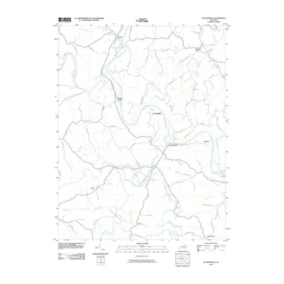
2010 Map of De Mossville
USGS Topo · Published 2010About this map
The Licking River carves a winding path through this northern Kentucky landscape, serving as the primary drainage for a network of named tributaries including Cruises Creek and Plum Creek. The settlement pattern is defined by river-valley hamlets and upland ridges, with Demossville and Morning View situated near the water, while Grants Lick and Alexandria occupy the higher ground to the northeast. This 2010 survey shows a complex rural road network connecting long-established family names to the land, visible through features like Caldwell Cemetery and Smith Cemetery. The topography is characterized by deep dissection, particularly where the North Fork Grassy Creek and South Fork Grassy Creek converge, creating the localized relief typical of the region's outer bluegrass geology. Smaller water bodies like Thorn Hill Lake and Campbell County Lake dot the northern reaches, providing local focal points amidst the many winding county roads.
Find a feature on this map
68 named features on this map. Tap any name to fly to it.
Don’t see what you’re looking for? This feature index may not catch every label — zoom into the map to look around manually.
Map Details
Editions of this 2010 De Mossville Map
This is the sole edition of this map. No revisions or reprints were ever made.
Other maps of this area

1929 · Alexandria
USGS Topo · 1:48,000

1930 · Falmouth
USGS Topo · 1:48,000

1936 · Alexandria
USGS Topo · 1:62,500

1936 · Falmouth
USGS Topo · 1:62,500

1950 · Williamstown
USGS Topo · 1:24,000

1950 · Independence
USGS Topo · 1:24,000

1950 · Walton
USGS Topo · 1:24,000

1953 · Butler
USGS Topo · 1:24,000

1953 · New Richmond
USGS Topo · 1:24,000
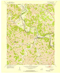
1953 · De Mossville
USGS Topo · 1:24,000