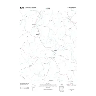
2013 Map of De Mossville
USGS Topo · Published 2013About this map
The Licking River winds through this Northern Kentucky landscape, serving as a primary corridor for small settlements like Kenton, Morning View, and DeMossville. The terrain is defined by prominent elevations such as Clay Ridge and Pleasant Ridge, while the valley floors are marked by productive bottomlands including Wilmington Bottom. This area shows a mix of rural community centers and recreational landmarks, most notably the Thorn Hill Drag Strip situated near Thorn Hill Lake.
Find a feature on this map
102 named features on this map. Tap any name to fly to it.
Don’t see what you’re looking for? This feature index may not catch every label — zoom into the map to look around manually.
Map Details
Editions of this 2013 De Mossville Map
This is the sole edition of this map. No revisions or reprints were ever made.
Other maps of this area

1929 · Alexandria
USGS Topo · 1:48,000

1930 · Falmouth
USGS Topo · 1:48,000

1936 · Alexandria
USGS Topo · 1:62,500

1936 · Falmouth
USGS Topo · 1:62,500

1950 · Williamstown
USGS Topo · 1:24,000

1950 · Independence
USGS Topo · 1:24,000

1950 · Walton
USGS Topo · 1:24,000

1953 · Butler
USGS Topo · 1:24,000

1953 · New Richmond
USGS Topo · 1:24,000
1953 · De Mossville
USGS Topo · 1:24,000