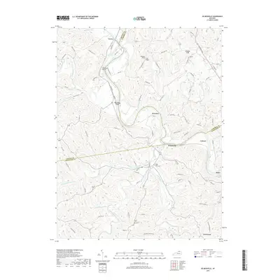
2019 Map of De Mossville
USGS Topo · Published 2019About this map
The Licking River carves a deep, winding path through the borderlands of Kenton, Campbell, and Pendleton Counties, defining the rural character of this northern Kentucky region. Smaller settlements like DeMossville, Morning View, and Grants Lick serve as focal points for the surrounding agricultural community, where ridges such as Pleasant Ridge and Clay Ridge separate numerous stream valleys. The geography of the area is heavily influenced by its hydrology, with drainage from Bloody Run, Cruises Creek, and the complex network of Grassy Creek feeding into the main river channel.
Find a feature on this map
94 named features on this map. Tap any name to fly to it.
Don’t see what you’re looking for? This feature index may not catch every label — zoom into the map to look around manually.
Map Details
Editions of this 2019 De Mossville Map
This is the sole edition of this map. No revisions or reprints were ever made.
Other maps of this area

1929 · Alexandria
USGS Topo · 1:48,000

1930 · Falmouth
USGS Topo · 1:48,000

1936 · Alexandria
USGS Topo · 1:62,500

1936 · Falmouth
USGS Topo · 1:62,500

1950 · Williamstown
USGS Topo · 1:24,000

1950 · Independence
USGS Topo · 1:24,000

1950 · Walton
USGS Topo · 1:24,000

1953 · Butler
USGS Topo · 1:24,000

1953 · New Richmond
USGS Topo · 1:24,000
1953 · De Mossville
USGS Topo · 1:24,000