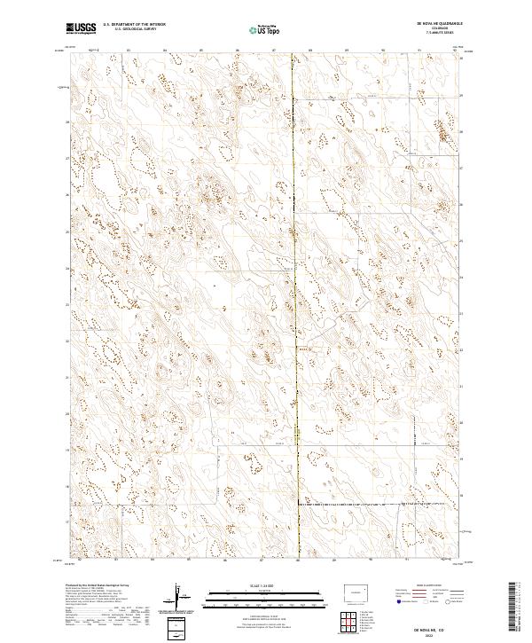
2022 Map of De Nova NE
USGS Topo · Published 2022About this map
Washington Co and Yuma Co meet along a straight north-south meridian in this high-plains landscape. The terrain is defined by a rhythmic series of northwest-to-southeast trending ridges and depressions, characteristic of the dune-like formations of the eastern Colorado plains. This 2022 survey documents a sparsely populated agricultural and ranching environment where the most prominent landmarks are the intersection of section lines and county roads. Transportation is confined to a strictly gridded network, featuring Co Rd A following the county boundary and other primary routes such as Co Rd 29 and Co Rd 27. The map illustrates the persistent influence of the Public Land Survey System, with township and range lines like t1s r49w and t1s r48w providing the underlying framework for land ownership and administration in this rural interior.
Find a feature on this map
17 named features on this map. Tap any name to fly to it.
Don’t see what you’re looking for? This feature index may not catch every label — zoom into the map to look around manually.
Map Details
Editions of this 2022 De Nova NE Map
This is the sole edition of this map. No revisions or reprints were ever made.
Other maps of this area

1954 · Limon
USGS Topo · 1:250,000

1954 · Sterling
USGS Topo · 1:250,000

1957 · Limon
USGS Topo · 1:250,000

1958 · Limon
USGS Topo · 1:250,000

1958 · Sterling
USGS Topo · 1:250,000

1972 · Snyder Lake
USGS Topo · 1:24,000

1972 · Otis SE
USGS Topo · 1:24,000

1972 · Yuma South
USGS Topo · 1:24,000

1974 · De Nova SE
USGS Topo · 1:24,000
1974 · Abarr
USGS Topo · 1:24,000