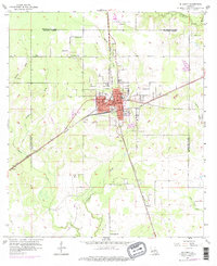
1956 Map of De Quincy
USGS Topo · Published 1976About this map
De Quincy serves as a busy rail junction in the mid-1950s, where the Kansas City Southern and Missouri Pacific lines converge. This transport hub is surrounded by active industrial extraction, evidenced by the North De Quincy Oil Field and the Perkins Oil and Gas Field to the south. The town layout is dense with civic infrastructure, including the Ward Sch and a central Depot, while the surrounding parish lands remain punctuated by rural landmarks such as Hargrove Ch and the Louisiana Correctional Institute to the north.
Find a feature on this map
32 named features on this map. Tap any name to fly to it.
Don’t see what you’re looking for? This feature index may not catch every label — zoom into the map to look around manually.
Map Details
Editions of this 1956 De Quincy Map
3 editions found
Other maps of this area

1935 · Buhler
USGS Topo · 1:31,680

1935 · Gordon
USGS Topo · 1:31,680

1947 · DeQuincy
USGS Topo · 1:31,680

1947 · Sulphur Mines
USGS Topo · 1:31,680

1947 · Oretta
USGS Topo · 1:31,680

1947 · Kernan
USGS Topo · 1:31,680

1947 · Hyatt
USGS Topo · 1:31,680

1947 · Lunita
USGS Topo · 1:31,680

1947 · Long Marsh
USGS Topo · 1:31,680

1949 · Kernan
USGS Topo · 1:31,680