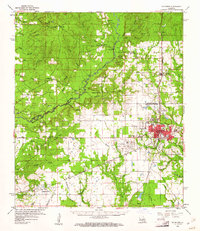
1960 Map of De Ridder
USGS Topo · Published 1961About this map
The rail-driven growth of De Ridder serves as the focal point of this 1960 survey, where the Kansas City Southern Ry and Gulf Colorado and Santa Fe Ry converge. This junction established the town as a regional hub for the timber and agricultural industries of southwestern Louisiana. The landscape surrounding the city is a complex network of waterways, including Anacoco Bayou and Marsh Bayou, which define the boundary between Vernon and Beauregard Parishes.
Find a feature on this map
61 named features on this map. Tap any name to fly to it.
Don’t see what you’re looking for? This feature index may not catch every label — zoom into the map to look around manually.
Map Details
Editions of this 1960 De Ridder Map
2 editions found
Other maps of this area

1941 · Leesville
USGS Topo · 1:62,500

1941 · Slagle
USGS Topo · 1:62,500

1943 · Leesville
USGS Topo · 1:62,500

1944 · Wiergate
USGS Topo · 1:62,500

1944 · Slagle
USGS Topo · 1:62,500

1946 · Leesville
USGS Topo · 1:62,500

1946 · Merryville
USGS Topo · 1:31,680

1947 · Singer
USGS Topo · 1:31,680

1947 · Pujo
USGS Topo · 1:31,680

1947 · DeRidder
USGS Topo · 1:31,680