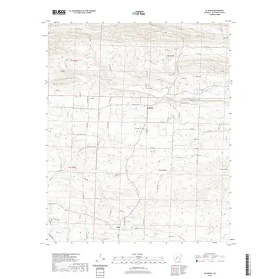
2020 Map of De Roche
USGS Topo · Published 2020About this map
De Roche and Caney serve as the primary focal points of this Hot Spring County landscape, situated within a topography defined by significant ridgelines and a network of named drainages. To the north, the elevation rises sharply at Jack Mtn, while the southeastern portion of the map is dominated by the DeLisle Hills. The area is historically grounded by its small family and community burial grounds, including Prince Cem, Estep Cem, and Holstein Cem, which are scattered among the ridges and valley floors. Waterways like Prairie Bayou, Blakely Cr, and Caney Cr dictate the layout of the local road system, which consists largely of named rural routes and ranch roads. The placement of these cemeteries and small settlements suggests a long-standing pattern of upland habitation, where residents utilized the natural corridors between the hills for transport and agriculture.
Find a feature on this map
87 named features on this map. Tap any name to fly to it.
Don’t see what you’re looking for? This feature index may not catch every label — zoom into the map to look around manually.
Map Details
Editions of this 2020 De Roche Map
This is the sole edition of this map. No revisions or reprints were ever made.
Other maps of this area

1948 · Malvern
USGS Topo · 1:62,500

1949 · Malvern
USGS Topo · 1:62,500

1955 · Little Rock
USGS Topo · 1:250,000

1956 · Little Rock
USGS Topo · 1:250,000

1959 · Caddo Valley
USGS Topo · 1:24,000

1960 · Little Rock
USGS Topo · 1:250,000

1964 · Little Rock
USGS Topo · 1:250,000

1964 · Donaldson
USGS Topo · 1:24,000

1966 · Hempwallace
USGS Topo · 1:24,000

1966 · De Roche
USGS Topo · 1:24,000