
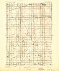
1899 Map of De Smet
USGS Topo · Published 1899About this map
De Smet serves as a prominent focal point in the late 19th-century Dakota landscape, where the Chicago and Northwestern R. R. and the Dakota Central Line intersect. This survey, conducted under director Charles D. Walcott, captures a region defined by a grid-like settlement pattern and a growing network of rail lines. The map reveals the intricate drainage system of the area, featuring Pearl Creek, Redstone Creek, and the headwaters of the Vermilion River. Smaller settlements like Esmond, Carthage, and Manchester appear along the rail corridors, illustrating the railroad's role in shaping the geography of these prairies. Genealogists and local historians can trace the early boundaries of Beadle, Kingsbury Co., Sanborn, and Miner Co., alongside numerous named townships such as Belle Prairie and Mathews.
Find a feature on this map
56 named features on this map. Tap any name to fly to it.
Don’t see what you’re looking for? This feature index may not catch every label — zoom into the map to look around manually.
Map Details
Editions of this 1899 De Smet Map
2 editions found
Other maps of this area

1895 · Byron
USGS Topo · 1:125,000

1898 · Huron
USGS Topo · 1:125,000

1899 · Mitchell
USGS Topo · 1:125,000

1899 · Alexandria
USGS Topo · 1:125,000

1953 · Huron
USGS Topo · 1:250,000

1953 · Watertown
USGS Topo · 1:250,000

1954 · Huron
USGS Topo · 1:250,000

1955 · Sioux Falls
USGS Topo · 1:250,000

1955 · Mitchell
USGS Topo · 1:250,000

1956 · Lake Byron SE
USGS Topo · 1:24,000