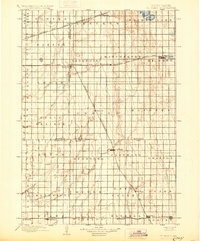
1899 Map of De Smet
USGS Topo · Published 1930About this map
De Smet serves as the focal point of this late 19th-century landscape, positioned at the crossing of the Minnesota and Dakota Line and the north-south boundary of Mathews township. The map illustrates a region defined by its rapid railroad development, with the Chicago and Northwestern R. R. and the Duluth Watertown and Pacific Line carving paths across the prairie to connect settlements like Iroquois and Manchester.
Find a feature on this map
50 named features on this map. Tap any name to fly to it.
Don’t see what you’re looking for? This feature index may not catch every label — zoom into the map to look around manually.
Map Details
Editions of this 1899 De Smet Map
2 editions found
Other maps of this area

1895 · Byron
USGS Topo · 1:125,000

1898 · Huron
USGS Topo · 1:125,000

1899 · Mitchell
USGS Topo · 1:125,000

1899 · Alexandria
USGS Topo · 1:125,000

1899 · De Smet
USGS Topo · 1:125,000

1953 · Huron
USGS Topo · 1:250,000

1953 · Watertown
USGS Topo · 1:250,000

1954 · Huron
USGS Topo · 1:250,000

1955 · Sioux Falls
USGS Topo · 1:250,000

1955 · Mitchell
USGS Topo · 1:250,000