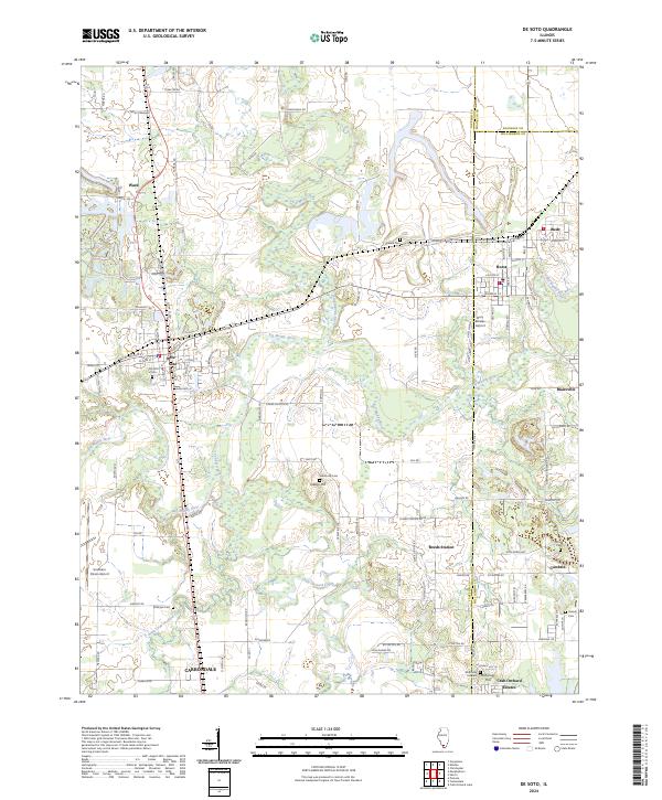
2024 Map of De Soto
USGS Topo · Published 2024About this map
De Soto and the surrounding Jackson County landscape are defined by a complex network of waterways, where the Big Muddy River and Little Muddy River converge amidst a pattern of rural settlements and modern aviation hubs. This 2024 survey captures the interface between established towns like Hurst and Bush and the expansive protected lands of the Crab Orchard National Wildlife Refuge in the southeast. The map is particularly useful for genealogical research, documenting numerous burial sites including De Soto Cem, Indian Hill Cem, and McKinney Hill Cem near McKinney Hill. Transportation and infrastructure are central to the area's layout, ranging from the activity at Southern Illinois Airport to the residential clusters of Crab Orchard Estates and Blairsville. The terrain transitions from the low-lying basins of Crab Orchard Creek to the named elevations that have long shaped the region's development and road networks.
Find a feature on this map
61 named features on this map. Tap any name to fly to it.
Don’t see what you’re looking for? This feature index may not catch every label — zoom into the map to look around manually.
Map Details
Editions of this 2024 De Soto Map
This is the sole edition of this map. No revisions or reprints were ever made.
Other maps of this area

1910 · Herrin
USGS Topo · 1:62,500

1910 · Murphysboro
USGS Topo · 1:62,500

1922 · Carbondale
USGS Topo · 1:62,500

1924 · Alto Pass
USGS Topo · 1:62,500

1936 · Herrin
USGS Topo · 1:62,500

1938 · Murphysboro
USGS Topo · 1:62,500

1941 · Carbondale
USGS Topo · 1:62,500

1947 · Alto Pass
USGS Topo · 1:62,500
1948 · Pomona
USGS Topo · 1:24,000
1949 · Alto Pass
USGS Topo · 1:62,500