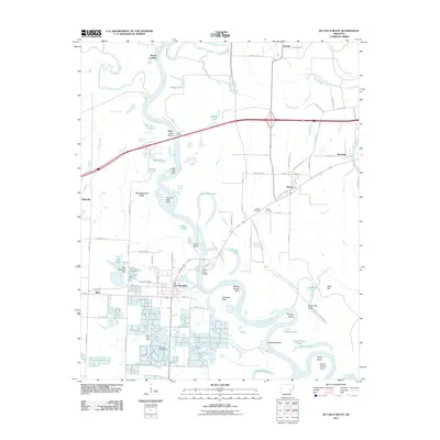
2011 Map of De Valls Bluff
USGS Topo · Published 2011About this map
De Valls Bluff sits at a major bend in the White River, serving as a central hub for river traffic and rail transport in Prairie County. The landscape is defined by the winding river and its complex system of backwaters, including Black Lake, Webb Lake, and Horseshoe Lake. The density of family and community landmarks, such as Oakland Cemetery and Pfennighausen Ridge, provides significant detail for local history research.
Find a feature on this map
90 named features on this map. Tap any name to fly to it.
Don’t see what you’re looking for? This feature index may not catch every label — zoom into the map to look around manually.
Map Details
Editions of this 2011 De Valls Bluff Map
This is the sole edition of this map. No revisions or reprints were ever made.
Other maps of this area

1935 · Hazen
USGS Topo · 1:62,500

1935 · Clarendon
USGS Topo · 1:62,500

1937 · Stuttgart
USGS Topo · 1:62,500

1939 · Stuttgart
USGS Topo · 1:62,500

1941 · Hazen
USGS Topo · 1:62,500

1941 · De Valls Bluff
USGS Topo · 1:62,500

1941 · Clarendon
USGS Topo · 1:62,500

1948 · Helena
USGS Topo · 1:250,000

1950 · Helena
USGS Topo · 1:250,000

1955 · Helena
USGS Topo · 1:250,000