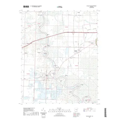
2020 Map of De Valls Bluff
USGS Topo · Published 2020About this map
The White River winds in deep oxbows through this portion of Prairie County, shaping the local geography from Bucks Landing down to Hider Bend. The historic river town of De Valls Bluff serves as a central hub, situated along a prominent bend where the river meets the southern wetlands. The settlement patterns reflect the era’s agricultural and transport infrastructure, with Hazen appearing to the west and the dual-named community of Fredonia (Biscoe) to the east. Genealogists will find notable burial sites including Oakland Cem near the bluff and Harris Cem further inland. The landscape is defined by its water-rich terrain, featuring numerous cutoff lakes like Old River, Black Lake, and Miers Lake, while topographic highlights such as Arkapola Bluff and Pfennighausen Ridge provide contrast to the low-lying bayous and sloughs that dominate the eastern section near Brasfield.
Find a feature on this map
81 named features on this map. Tap any name to fly to it.
Don’t see what you’re looking for? This feature index may not catch every label — zoom into the map to look around manually.
Map Details
Editions of this 2020 De Valls Bluff Map
This is the sole edition of this map. No revisions or reprints were ever made.
Other maps of this area

1935 · Hazen
USGS Topo · 1:62,500

1935 · Clarendon
USGS Topo · 1:62,500

1937 · Stuttgart
USGS Topo · 1:62,500

1939 · Stuttgart
USGS Topo · 1:62,500

1941 · Hazen
USGS Topo · 1:62,500

1941 · De Valls Bluff
USGS Topo · 1:62,500

1941 · Clarendon
USGS Topo · 1:62,500

1948 · Helena
USGS Topo · 1:250,000

1950 · Helena
USGS Topo · 1:250,000

1955 · Helena
USGS Topo · 1:250,000