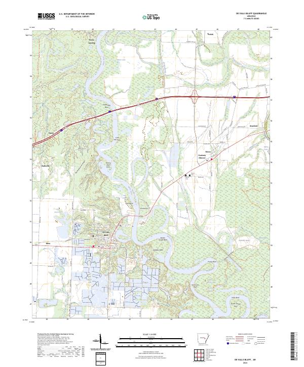
2024 Map of De Valls Bluff
USGS Topo · Published 2024About this map
The White River carves a winding path through the center of this Prairie County landscape, defining the boundaries of the Cache River National Wildlife Refuge. This riverine environment is characterized by dramatic features like Arkapola Bluff and Worshams Bluff, while numerous backwater oxbows such as Old River, Black Lake, and Moores Lake mark the historic shifts of the watercourse. The settlement of De Valls Bluff sits strategically on the western bank, connected to Mesa and Hazen by the Union Pacific Railroad corridor.
Find a feature on this map
105 named features on this map. Tap any name to fly to it.
Don’t see what you’re looking for? This feature index may not catch every label — zoom into the map to look around manually.
Map Details
Editions of this 2024 De Valls Bluff Map
This is the sole edition of this map. No revisions or reprints were ever made.
Other maps of this area

1935 · Hazen
USGS Topo · 1:62,500

1935 · Clarendon
USGS Topo · 1:62,500

1937 · Stuttgart
USGS Topo · 1:62,500

1939 · Stuttgart
USGS Topo · 1:62,500

1941 · Hazen
USGS Topo · 1:62,500

1941 · De Valls Bluff
USGS Topo · 1:62,500

1941 · Clarendon
USGS Topo · 1:62,500

1948 · Helena
USGS Topo · 1:250,000

1950 · Helena
USGS Topo · 1:250,000

1955 · Helena
USGS Topo · 1:250,000