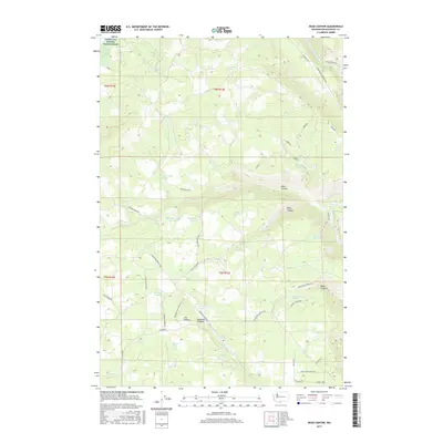
2017 Map of Dead Canyon
USGS Topo · Published 2017About this map
The Klickitat River carves through the eastern edge of this landscape, flanked by a complex network of timber and access roads including River Route Rd and Company Rd. The terrain is defined by its deep drainages, most notably Dead Canyon, Willis Canyon, and Skookum Canyon, which cut through the high ground of The Plateau. This area in Klickitat County is characterized by its vital water sources, as evidenced by the high density of named springs like Wellenbrock Spring, Kuhnhausen Spring, and Masondale Spring. The northwest corner touches the Conboy Lake National Wildlife Refuge, marking a transition toward the protected wetlands of the Glenwood area. Local ranching and land management history is reflected in the naming of infrastructure, such as Division Fence Rd and Pasture Fence Rd.
Find a feature on this map
60 named features on this map. Tap any name to fly to it.
Don’t see what you’re looking for? This feature index may not catch every label — zoom into the map to look around manually.
Map Details
Editions of this 2017 Dead Canyon Map
This is the sole edition of this map. No revisions or reprints were ever made.
Other maps of this area

1904 · Mount Adams
USGS Topo · 1:125,000

1907 · Mount Adams
USGS Topo · 1:125,000

1934 · The Dalles
USGS Topo · 1:125,000

1950 · Yakima
USGS Topo · 1:250,000

1953 · The Dalles
USGS Topo · 1:250,000

1956 · The Dalles
USGS Topo · 1:250,000

1957 · The Dalles
USGS Topo · 1:250,000

1957 · Klickitat
USGS Topo · 1:62,500

1957 · Husum
USGS Topo · 1:62,500

1958 · Yakima
USGS Topo · 1:250,000