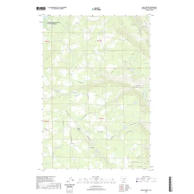
2020 Map of Dead Canyon
USGS Topo · Published 2020About this map
Conboy Lake National Wildlife Refuge anchors the northwest corner of this Klickitat County landscape, marking a transition between the wetlands of the Camas Prairie and the deeply incised drainage systems to the east. The terrain is defined by a series of significant erosional features including Dead Canyon, Willis Canyon, and Skookum Canyon, which cut through the high ground of The Plateau toward the Klickitat River valley.
Find a feature on this map
59 named features on this map. Tap any name to fly to it.
Don’t see what you’re looking for? This feature index may not catch every label — zoom into the map to look around manually.
Map Details
Editions of this 2020 Dead Canyon Map
This is the sole edition of this map. No revisions or reprints were ever made.
Other maps of this area

1904 · Mount Adams
USGS Topo · 1:125,000

1907 · Mount Adams
USGS Topo · 1:125,000

1934 · The Dalles
USGS Topo · 1:125,000

1950 · Yakima
USGS Topo · 1:250,000

1953 · The Dalles
USGS Topo · 1:250,000

1956 · The Dalles
USGS Topo · 1:250,000

1957 · The Dalles
USGS Topo · 1:250,000

1957 · Klickitat
USGS Topo · 1:62,500

1957 · Husum
USGS Topo · 1:62,500

1958 · Yakima
USGS Topo · 1:250,000