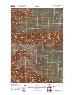
2011 Map of Dead Dog Canyon
USGS Topo · Published 2011About this map
Buzan Cemetery and the settlement at Flanagan anchor this 2011 perspective of the Wasco County landscape, where the drainage patterns of the high plateau define local geography. The map illustrates a network of deep incisions into the earth, notably Dead Dog Canyon, Mays Grade Canyon, and Smith Canyon. These landforms, along with the prominent rise of the Sugarloaf, dictate the placement of local thoroughfares like Bakeoven Rd and Buckley Rd.
Find a feature on this map
20 named features on this map. Tap any name to fly to it.
Don’t see what you’re looking for? This feature index may not catch every label — zoom into the map to look around manually.
Map Details
Editions of this 2011 Dead Dog Canyon Map
This is the sole edition of this map. No revisions or reprints were ever made.
Other maps of this area

1930 · Dufur
USGS Topo · 1:125,000

1934 · Dufur
USGS Topo · 1:125,000

1953 · The Dalles
USGS Topo · 1:250,000

1956 · The Dalles
USGS Topo · 1:250,000

1957 · The Dalles
USGS Topo · 1:250,000

1962 · Sherars Bridge
USGS Topo · 1:24,000
1962 · Dant
USGS Topo · 1:24,000

1962 · Sinamox
USGS Topo · 1:24,000

1962 · Grass Valley
USGS Topo · 1:24,000
1962 · Maupin
USGS Topo · 1:24,000