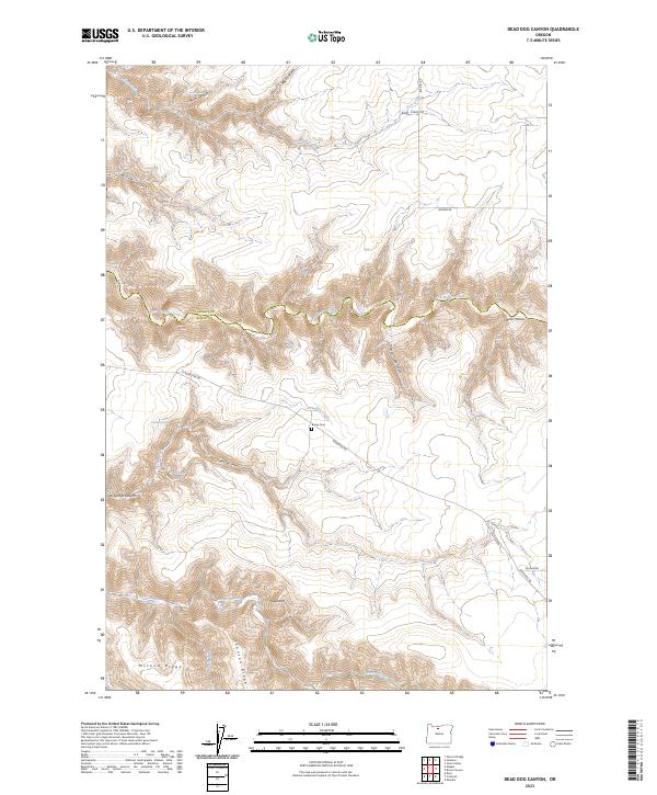
2023 Map of Dead Dog Canyon
USGS Topo · Published 2023About this map
Buck Hollow and the surrounding canyonlands of the Oregon high desert define this 2023 survey along the border of Wasco and Sherman Counties. The landscape is dominated by complex drainage systems and ridges, including the prominent McLeod Ridge and Johnson Ridge, which rise above the deep incisions of Dead Dog Canyon and Salt Springs Canyon. Significant water sources in this arid region are marked by several springs such as Gamber Spring and Denny Spring.
Find a feature on this map
28 named features on this map. Tap any name to fly to it.
Don’t see what you’re looking for? This feature index may not catch every label — zoom into the map to look around manually.
Map Details
Editions of this 2023 Dead Dog Canyon Map
This is the sole edition of this map. No revisions or reprints were ever made.
Other maps of this area

1930 · Dufur
USGS Topo · 1:125,000

1934 · Dufur
USGS Topo · 1:125,000

1953 · The Dalles
USGS Topo · 1:250,000

1956 · The Dalles
USGS Topo · 1:250,000

1957 · The Dalles
USGS Topo · 1:250,000

1962 · Sherars Bridge
USGS Topo · 1:24,000
1962 · Dant
USGS Topo · 1:24,000

1962 · Sinamox
USGS Topo · 1:24,000

1962 · Grass Valley
USGS Topo · 1:24,000
1962 · Maupin
USGS Topo · 1:24,000