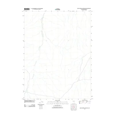
2011 Map of Dead Horse Canyon NE
USGS Topo · Published 2011About this map
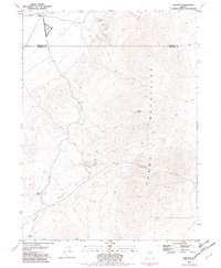
Granite Springs Wash defines the drainage patterns of this arid landscape within Pershing County, cutting a meandering path from the northwest toward the southern reaches of the quadrangle. This 2011 survey illustrates the subtle topographic variations in a region shaped by intermittent water flow and alluvial processes. The sparse human infrastructure, limited primarily to primitive roads and tracks, underscores the isolation of this high desert environment. While the map is geographically focused on the natural hydrology of the wash, the detailed contour intervals from the U.S. Geological Survey allow for a precise reading of the basin's floor and the surrounding desert floor as it appeared in the early 21st century.
Find a feature on this map
1 named feature on this map. Tap any name to fly to it.
Don’t see what you’re looking for? This feature index may not catch every label — zoom into the map to look around manually.
Map Details
Editions of this 2011 Dead Horse Canyon NE Map
This is the sole edition of this map. No revisions or reprints were ever made.
Other maps of this area

1931 · Lovelock
USGS Topo · 1:250,000

1935 · Lovelock
USGS Topo · 1:250,000

1955 · Lovelock
USGS Topo · 1:250,000

1959 · Lovelock
USGS Topo · 1:250,000
1981 · Sheep Spring
USGS Topo · 1:24,000
1981 · Dead Horse Canyon
USGS Topo · 1:24,000

1981 · Dead Horse Canyon NE
USGS Topo · 1:24,000

1981 · Placerites
USGS Topo · 1:24,000
1981 · Cholona
USGS Topo · 1:24,000
1981 · Sulphur
USGS Topo · 1:24,000