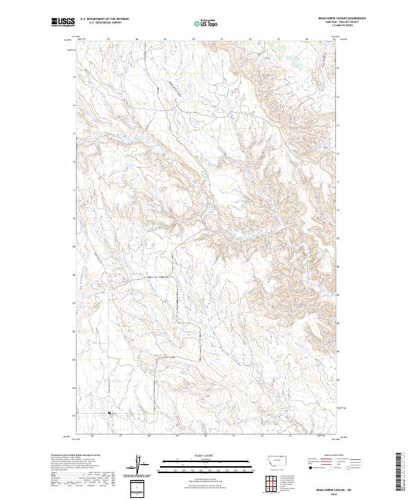
2024 Map of Dead Horse Coulee
USGS Topo · Published 2024About this map
Reitan Cem stands as a lonely landmark in the southern reaches of this Phillips County landscape, offering a specific point of interest for genealogists and local historians. The terrain is defined by a network of drainage systems, including the central Dead Horse Coulee and the meandering Cottonwood Creek. These coulees and creek beds dictate the movement across the land, with Turkey Track Rd cutting through the western portion of the quadrangle. Other notable waterways such as Corral Coulee, Peck Coulee, and East Fork Stinky Creek illustrate the erosive forces that have shaped this portion of northern Montana. The map provides a contemporary view of these traditional land divisions, preserving the location of family-named sites amidst the section lines of the Public Land Survey System.
Find a feature on this map
11 named features on this map. Tap any name to fly to it.
Don’t see what you’re looking for? This feature index may not catch every label — zoom into the map to look around manually.
Map Details
Editions of this 2024 Dead Horse Coulee Map
This is the sole edition of this map. No revisions or reprints were ever made.
Other maps of this area

1954 · Glasgow
USGS Topo · 1:250,000

1957 · Glasgow
USGS Topo · 1:250,000

1958 · Glasgow
USGS Topo · 1:250,000

1984 · Thoeny Hills East
USGS Topo · 1:24,000

1984 · Forks
USGS Topo · 1:24,000

1984 · Coulter Coulee
USGS Topo · 1:24,000

1984 · Dead Horse Coulee
USGS Topo · 1:24,000

1984 · Crow Creek Dam
USGS Topo · 1:24,000
1984 · Thoeny Hills West
USGS Topo · 1:24,000
1984 · Salsbery Reservoir
USGS Topo · 1:24,000