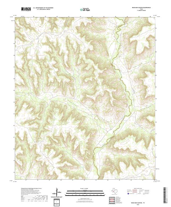
2022 Map of Dead Man Canyon
USGS Topo · Published 2022About this map
The Pecos River carves a deep path through the West Texas landscape, serving as the border between Terrell Co and Crockett Co. This 2022 survey details the intricate network of canyons that feed toward the river valley, including the prominent Dead Man Canyon and Reagan Canyon. The terrain is characterized by these narrow, winding passages such as Loftin Canyon and a series of numbered draws labeled First Canyon, Second Canyon, and Third Canyon. Human presence is sparse, limited to remote ranch roads like Ingham Dudley Rd and Dunlap Rd. The location of Cedar Springs provides a rare water source in this arid environment, illustrating the geographic isolation and specialized land use common in this stretch of the Trans-Pecos region.
Find a feature on this map
12 named features on this map. Tap any name to fly to it.
Don’t see what you’re looking for? This feature index may not catch every label — zoom into the map to look around manually.
Map Details
Editions of this 2022 Dead Man Canyon Map
This is the sole edition of this map. No revisions or reprints were ever made.
Other maps of this area

1929 · Sheffield
USGS Topo · 1:125,000

1954 · Sonora
USGS Topo · 1:250,000

1958 · Sonora
USGS Topo · 1:250,000

1967 · Burnt Canyon
USGS Topo · 1:24,000

1967 · Fort Lancaster
USGS Topo · 1:24,000

1967 · Bachelor Hill
USGS Topo · 1:24,000

1967 · Sheffield SE
USGS Topo · 1:24,000

1967 · Dead Man Canyon
USGS Topo · 1:24,000
1967 · Sheffield
USGS Topo · 1:24,000
1970 · Prince Albert Draw
USGS Topo · 1:24,000