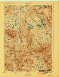
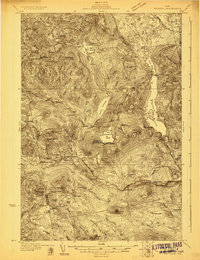
1928 Map of Dead River
USGS Topo · Published 1942About this map
Dead River flows through this Somerset County landscape, anchoring a network of remote plantations and seasonal settlements surveyed in the mid-1920s. The region is defined by the historic carrying places between the great ponds, such as West Carry Pond and East Carry, which served as critical transit points for woodsmen and early sporting camps. Small-scale agricultural and homesteading sites like Joe Farm, Spring Farm, and Records appear alongside established institutions including the Highland School and Mill School. The map reflects an era before widespread modernization, where life revolved around the Carrabassett River and the rugged peaks of Stewart Mtn and Little Bigelow Mtn. This topographic record provides a look at the backcountry infrastructure of central Maine, from the isolated West Carry Camps to the named ledges and brooks that guided travelers through these wooded plantations.
Find a feature on this map
96 named features on this map. Tap any name to fly to it.
Don’t see what you’re looking for? This feature index may not catch every label — zoom into the map to look around manually.
Map Details
Editions of this 1928 Dead River Map
6 editions found
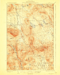
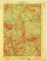
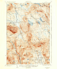

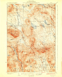
Other maps of this area

1903 · Bingham
USGS Topo · 1:62,500

1904 · Anson
USGS Topo · 1:62,500

1905 · Bingham
USGS Topo · 1:62,500

1905 · The Forks
USGS Topo · 1:62,500

1907 · The Forks
USGS Topo · 1:62,500

1925 · Pierce Pond
USGS Topo · 1:48,000

1927 · Pierce Pond
USGS Topo · 1:62,500
1928 · Spencer
USGS Topo · 1:48,000
1928 · Dead River
USGS Topo · 1:62,500
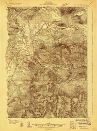
1928 · Stratton
USGS Topo · 1:48,000
Featured Places
- Kingfield, ME
- Carrabassett Valley, ME
- Pleasant Ridge Plantation, ME
- Caratunk, ME
- Highland Plantation, ME