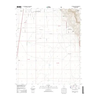
2013 Map of Deadman Canyon
USGS Topo · Published 2013About this map
The Sacramento Mountains rise abruptly from the Tularosa Basin floor, creating a dramatic topographical transition near Valmont. While the western portion of this 2013 survey is dominated by the grid of Dog Canyon Estates and the open expanse of the Fort Bliss Military Res, the eastern half climbs into the protected lands of the Lincoln National Forest. This rugged verticality is defined by deep cuts such as Deadman Canyon and Escondido Canyon, where vital water sources like Lawson Spring and Laney Spring are tucked away. On the lower, arid plains, water management is visible through features like the Langford Windmill and several catchment basins including Tony Tank and Fish Tank, illustrating the infrastructure required for ranching and settlement in the New Mexico desert.
Find a feature on this map
46 named features on this map. Tap any name to fly to it.
Don’t see what you’re looking for? This feature index may not catch every label — zoom into the map to look around manually.
Map Details
Editions of this 2013 Deadman Canyon Map
This is the sole edition of this map. No revisions or reprints were ever made.
Other maps of this area

1916 · Point Of Sands
USGS Topo · 1:125,000

1948 · Tres Hermanos
USGS Topo · 1:62,500

1948 · Holloman
USGS Topo · 1:62,500

1950 · Escondido Canyon
USGS Topo · 1:62,500

1950 · Alamogordo
USGS Topo · 1:62,500

1954 · Carlsbad
USGS Topo · 1:250,000

1955 · Las Cruces
USGS Topo · 1:250,000

1958 · Las Cruces
USGS Topo · 1:250,000

1958 · Carlsbad
USGS Topo · 1:250,000

1976 · Mule Peak
USGS Topo · 1:24,000