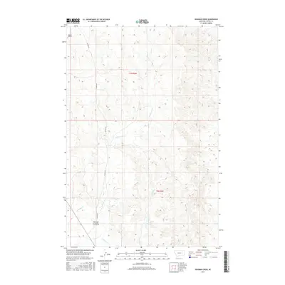
2017 Map of Deadman Creek
USGS Topo · Published 2017About this map
Deadman Creek winds through the dry, dissected plains of Custer County, serving as the primary hydrological feature of this remote Montana landscape. The terrain is defined by a network of drainage systems, including Owens Coulee in the northwest and Cow Cr in the northeast, which carve out the high prairie. Human infrastructure is sparse, concentrated primarily along Deadman Rd, which provides the main north-south access through the area. A notable point of interest is the North Fork of Sunday Creek Bridge, which crosses over the drainage of N Sunday Cr near the southern boundary of the quadrangle. This area, divided between t10n r46e and t9n r46e, illustrates the enduring structure of the Public Land Survey System in defining western land management, even as the seasonal flows of Crooked Cr continue to shape the physical topography.
Find a feature on this map
9 named features on this map. Tap any name to fly to it.
Don’t see what you’re looking for? This feature index may not catch every label — zoom into the map to look around manually.
Map Details
Editions of this 2017 Deadman Creek Map
This is the sole edition of this map. No revisions or reprints were ever made.
Other maps of this area

1953 · Miles City
USGS Topo · 1:250,000

1954 · Forsyth
USGS Topo · 1:250,000

1957 · Miles City
USGS Topo · 1:250,000

1957 · Forsyth
USGS Topo · 1:250,000

1958 · Miles City
USGS Topo · 1:250,000

1958 · Forsyth
USGS Topo · 1:250,000

1968 · Big Hill
USGS Topo · 1:24,000

1968 · Miles City
USGS Topo · 1:24,000

1968 · Butterfly Creek
USGS Topo · 1:24,000

1969 · Horse Creek Hill
USGS Topo · 1:24,000